6 cuotas sin interés de $ 8.249,85
$ 2.152.999
Precio sin Impuestos Nacionales$ 1,779,338
6 cuotas sin interés de $ 358.833,17
O en 1 pago
$
1.937.699
10%
Ingresá el Código Postal para ver tus opciones de Envío y Retiro:
Descripción


 Especificaciones
En la caja
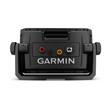
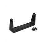
echoMAP UHD 92sv con mapa base mundial Transductor GT56UHD-TM Cable cargador/datos Soporte inclinable/giratorio con soporte de sujeción de desmontaje rápido Soporte para montaje empotrado Tapa de protección Hardware Documentación echoMAP UHD 92sv con mapa base mundial Cable cargador/datos Soporte inclinable/giratorio con soporte de sujeción de desmontaje rápido Soporte para montaje empotrado Tapa de protección Hardware Documentación
Productos compatibles
Descripción
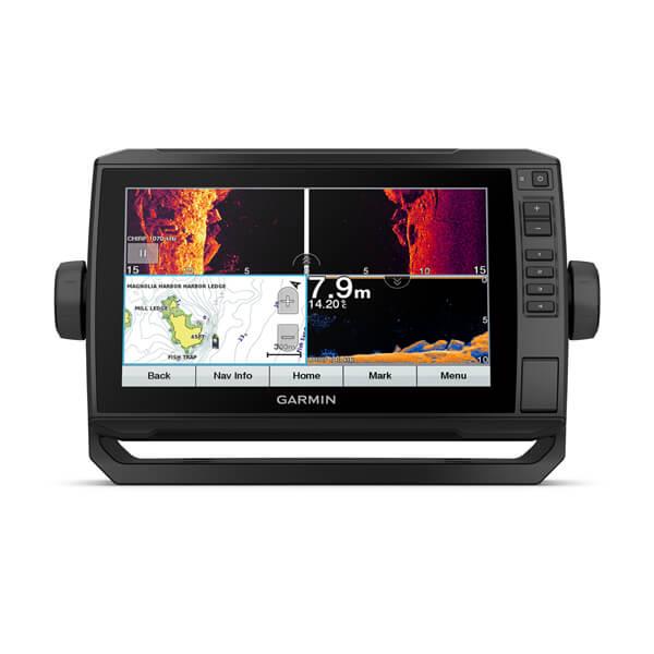
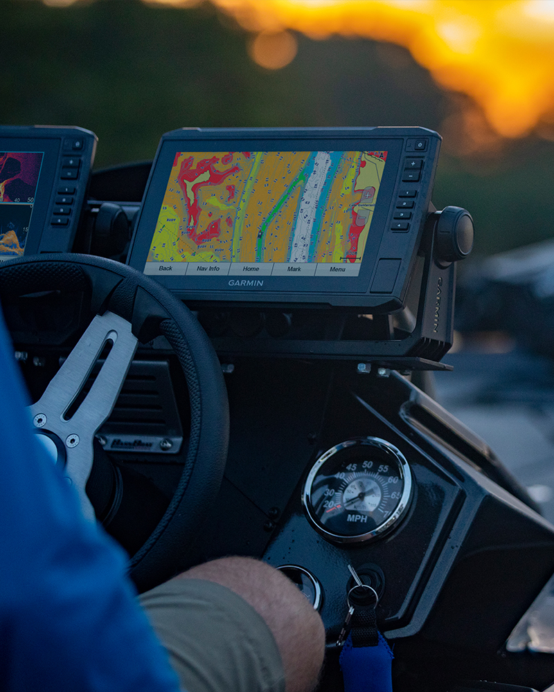
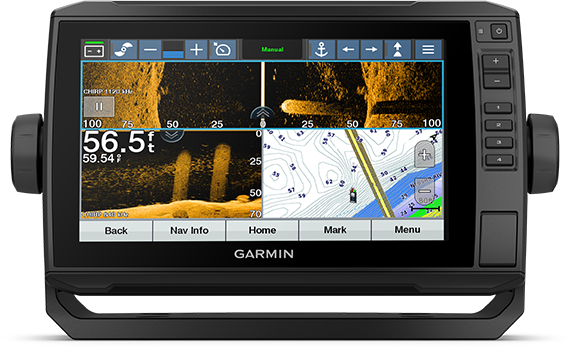
El plotter con pantalla táctil de 9” legible a la luz del sol cuenta con un soporte de soporte de liberación rápida, y el paquete de transductores agrega una sonda de exploración de ultra alta definición y una sonda tradicional CHIRP.
The sunlight-readable 9” touchscreen chartplotter features a quick-release bail mount, and the transducer bundle adds Ultra High-Definition scanning sonar and CHIRP traditional sonar.
See below and around your boat in incredible detail with the transducer bundle.
Navigate any waters with optional charts and maps (sold separately).
Share data and maps with select ECHOMAP devices on your network.
Manage your marine experience from nearly anywhere1.
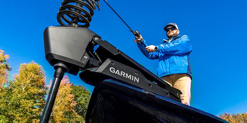
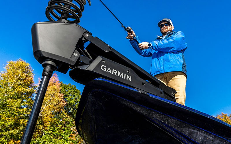
Control the most powerful trolling motor available2.
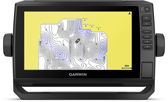
Create your own maps on the fly and tailor them to fit your needs.
Take fishing to the next level.

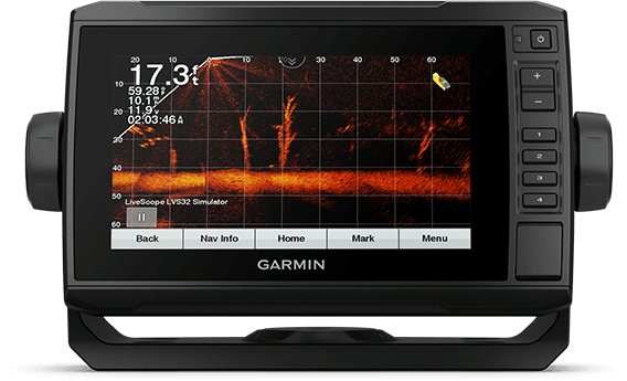
SONAR SUPPORT
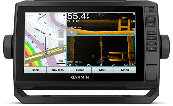
This chartplotter supports a variety of Garmin transducers (sold separately), including the Panoptix LiveScope™ scanning sonar system, which lets you see all around your boat in real time.

VIVID COLOR PALETTES
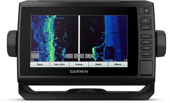
High-contrast vivid scanning sonar color palettes make it easier than ever to distinguish targets and structure.

OPTIONAL TRANSDUCER BUNDLE
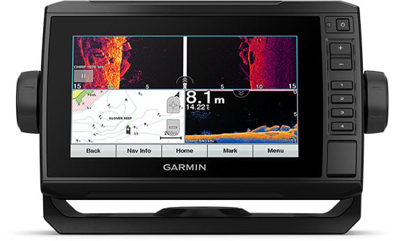
Select the transducer bundle to add a GT56 transducer for Garmin CHIRP traditional sonar and Ultra High-Definition ClearVü and SideVü scanning sonars. With three scanning sonar frequencies and 20% greater range for our UHD SideVü sonar, you’ll get top performance at all depths.

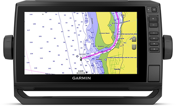
OPTIONAL CHARTS AND MAPS
Experience unparalleled coverage and detail with support for optional BlueChart® g3 Vision coastal charts featuring integrated Garmin and Navionics® content.

QUICKDRAW CONTOURS
Create personalized fishing maps on-screen with 1’ contours. Keep the data to yourself, or share it with the Quickdraw Community on the Garmin Connect™ app3.
Boat connected.

NETWORK CAPABLE
If you have multiple compatible ECHOMAP UHD or ECHOMAP Ultra devices on your boat, the 7” and 9” models can share information — such as sonar, user data and charts — with them.

NMEA 2000® AND NMEA 0183 NETWORKS
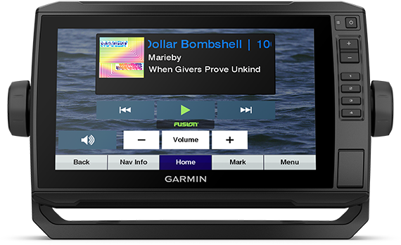
Connect to your compatible autopilots, digital switching, weather, Fusion-Link™ audio system, media, VHF, AIS, engine data, heading sensors — such as the SteadyCast™ sensor — and more from one screen.

ACTIVECAPTAIN® APP
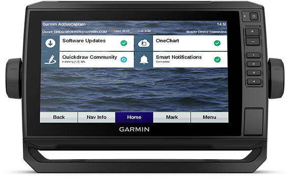
Built-in Wi-Fi® connectivity pairs with the free all-in-one mobile app for access to the OneChart™ feature, smart notifications, software updates, Garmin Quickdraw™ Community data and more1.

FORCE® TROLLING MOTOR COMPATIBILITY
Take control of the most powerful and efficient trolling motor available2, route it to waypoints, follow tracks and more from the screen of your chartplotter.
1 Requires the ActiveCaptain app on your compatible smartphone paired to the ECHOMAP UHD 92sv
2 In compliance with ISO standard 13342
3 Requires app on your compatible smartphone
Wi-Fi is a registered trademark of the Wi-Fi Alliance.
Especificaciones
Mapas y memoria
| PISTAS | 50 saved tracks |
| PUNTOS DE TRACK | 50 |
| RUTAS | 100 |
| WAYPOINTS | 5000 |
| ACEPTA TARJETAS DE DATOS | 1 tarjeta microSD™; tamaño máximo de 32 GB |
Mapas incorporados
| PREDICCIÓN DE MAREAS |
Soporte de mapa opcional
| GARMIN NAVIONICS VISION+™ | |
| GARMIN NAVIONICS+™ | |
| GARMIN QUICKDRAW CONTOURS | |
| LAKEVÜ G3 | |
| LAKEVÜ G3 ULTRA | |
| MAPAS ESTÁNDAR | |
| TOPO |
Funciones del plotter
| ADMITE AIS (RASTREA LA POSICIÓN DE LOS BARCOS OBJETIVO) | |
| AMITE DSC (ENVÍA LOS DATOS DE POSICIÓN AL VHF COMPATIBLE CON DSC) | |
| COMPATIBLE CON BLUECHART® MOBILE | |
| COMPATIBLE CON RADIOS Y FUSION LYNC | |
| CONTROL INALÁMBRICO | |
| SAILING FEATURES |
Especificaciones y funciones de sonda
| CLEARVÜ | built-in 260/455/800/1000/1200 kHz |
| LIVESCOPE | |
| MUESTRA UNA SONDA | |
| PANOPTIX™ SONAR | |
| SALIDA DE POTENCIA | 500 W |
| SIDEVÜ | built-in 260/455/800/1000/1200 kHz |
| SONDA TRADICIONAL (FRECUENCIA DUAL/HAZ) | built-in (single channel CHIRP, 70/83/200 kHz, L, M, H CHIRP) |
Conexiones
| PUERTOS DE ENTRADA (TX) NMEA 0183 | 1 |
| PUERTOS DE ENTRADA DE VÍDEO - NINGUNO | Ninguna |
| PUERTOS DE ENTRADA NMEA 0183 | 1 |
| PUERTOS DE SALIDA DE VÍDEO - NINGUNO | Ninguna |
| PUERTOS GARMIN MARINE NETWORK™ | 1 puerto Panoptix™ |
| PUERTOS NMEA 2000® | 1 |
| TRANSDUCTOR DE 12 PINES | 1 |
Eléctricas
| CONSUMO MÁXIMO DE CORRIENTE EN 12 V CC | 1.5 A |
| ENTRADA DE ALIMENTACIÓN | 9 to 18 Vdc |
| USO MÁXIMO DE ENERGÍA EN 10 V CC | 18W |
| CONSUMO DE CORRIENTE TÍPICO EN 12 V CC | 1.0 A |
Características físicas y de rendimiento
| OPCIONES DE MONTAJE | En superficie o empotrado |
| PANTALLA TÁCTIL | |
| PESO | 1,0 kg |
| TIPO DE PANTALLA | Pantalla WVGA |
| CLASIFICACIÓN DE RESISTENCIA AL AGUA | IPX7 |
| DIMENSIONES FÍSICAS | 26.3 x 16.5 x 6.5 cm |
Sensores
| COMPATIBLE CON NMEA 0183 | |
| COMPATIBLE CON NMEA 2000® | |
| COMPATIBLE CON WAAS | |
| CON RECEPTOR INTEGRADO | |
| GPS | |
| RECEPTOR | 5 Hz |
Caja de sonido
| Peso de la caja | 3.0053445 |
Otros
| RECEPTOR | 5 Hz |
| CONSUMO DE CORRIENTE TÍPICO EN 12 V CC | 1.0 A |
| COMPATIBLE CON RADIOS Y FUSION LYNC | |
| PREDICCIÓN DE MAREAS | |
| CLEARVÜ | built-in 260/455/800/1000/1200 kHz |
| CONTROL INALÁMBRICO | |
| MUESTRA UNA SONDA | |
| PANTALLA TÁCTIL | |
| RUTAS | 100 |
| PANOPTIX™ SONAR | |
| OPCIONES DE MONTAJE | En superficie o empotrado |
| USO MÁXIMO DE ENERGÍA EN 10 V CC | 18W |
| GPS | |
| TIPO DE PANTALLA | Pantalla WVGA |
| BOTONES DE AYUDA CON TECLAS | Pantalla táctil con teclas |
| ENTRADA DE ALIMENTACIÓN | 9 to 18 Vdc |
Con transductor
Sin transductor
¡Bienvenido al sitio!
Cambiá el código postal para ver las mejores opciones de envío y retiro de otra ubicación.
No sé mi código

